
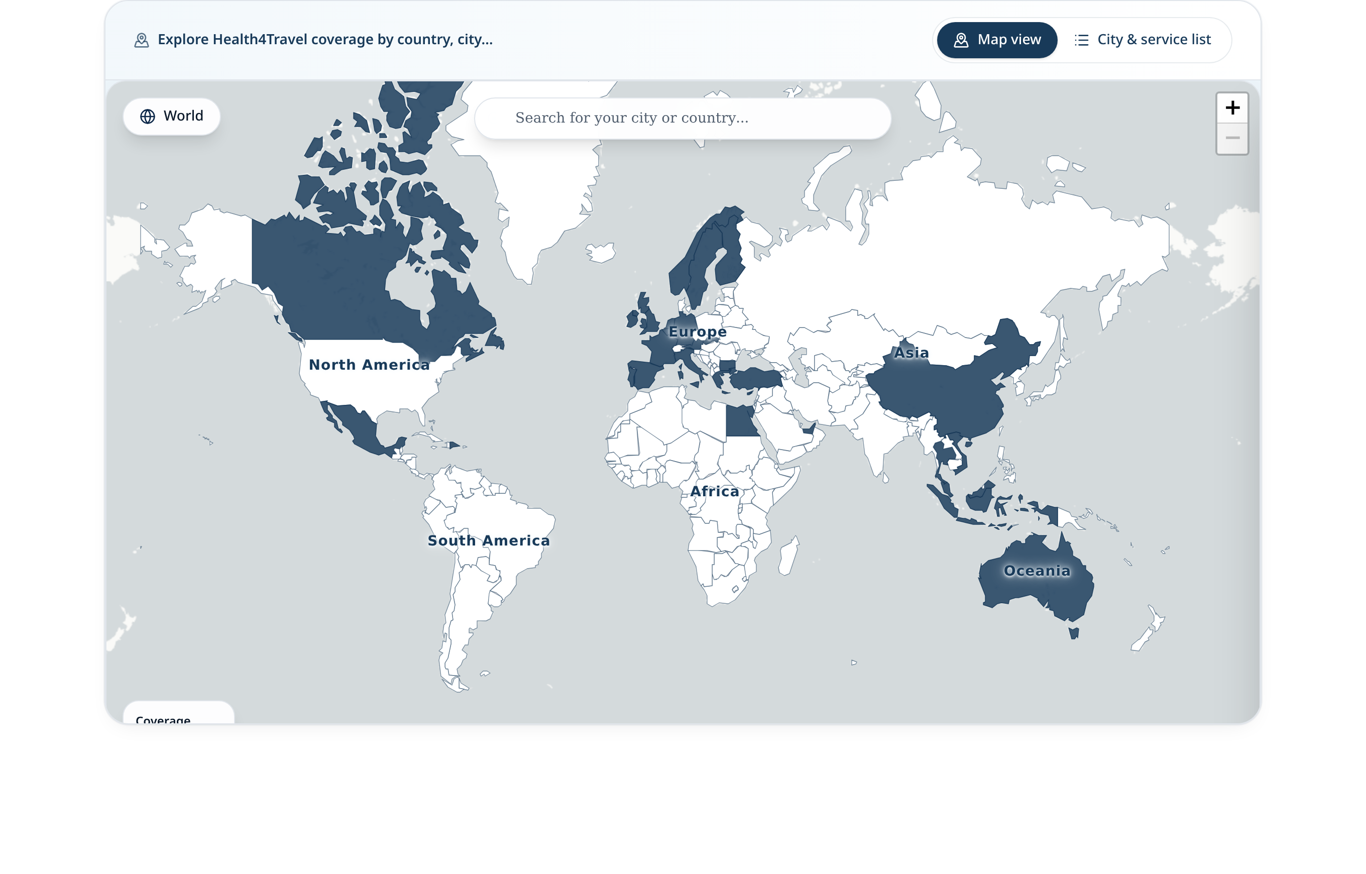
The Health4Travel coverage map gives Global Assistance teams, insurers and partners a single, structured view of where the network can support travellers. It currently reflects 31 countries, 182 cities and a growing range of outpatient service categories — from general practice and dentistry to specialist consultations and telehealth.
Why coverage visibility matters
Assistance teams and insurers need to answer one question quickly: is this destination covered? Without a shared reference, the answer lives across internal spreadsheets, emails and provider lists. A single coverage view removes that friction so member conversations, network planning and partner discussions all start from the same picture.
What the Health4Travel coverage map shows
The map represents the current Health4Travel provider network by country and city. Each supported country highlights on the world view, and a city and service list is available alongside the map for a structured breakdown by service category.
- 31 countries with active Health4Travel providers.
- 182 cities represented across those countries.
- A growing range of outpatient service categories, including general practice, dentistry, specialist consultations and telehealth.
The public view intentionally stays at country, city and service level — clinic addresses, contact details and appointment-level data are not exposed.
How Global Assistance teams can use the map
Global Assistance teams use the coverage map as a shared reference point for outpatient cases before they enter the dashboard workflow.
- Check at a glance whether a destination is represented in the network.
- Identify gaps and prioritise regions for expansion with the Health4Travel team.
- Share one link with internal stakeholders instead of sending updated spreadsheets.
- Prepare briefings and partner conversations without exposing clinic-level details.
How insurers and providers can use the map
Insurers use the map to evaluate outpatient coverage alongside their existing assistance and inpatient networks. Provider partners use it to understand how their city or country fits into the broader Health4Travel footprint.
- Insurers: match travel product footprints against Health4Travel outpatient coverage before rollout.
- Providers: see where the network is active and support conversations with new clinics considering it.
- Business development: coordinate joint outreach in cities with lighter coverage.
How coverage information should be interpreted
Coverage information is updated as the Health4Travel network develops. Because it reflects the network at any given point in time — and because provider availability varies by location, service and schedule — a few principles apply.
- A supported country or city does not mean every service is available in that city.
- Coverage does not confirm real-time appointment availability for a specific member.
- The public map does not replace emergency services — in an emergency, members should call the local emergency number.
- Clinical outcomes and insurance reimbursement depend on the provider and the member's policy.
Practical next steps
The coverage map is a starting point. From there, most teams either explore the map directly, or set up a short conversation to review how coverage fits their assistance or insurance workflow.
- Open the interactive coverage map to review current countries, cities and services.
- Share the map with internal stakeholders and Global Assistance partners.
- Book a meeting to discuss coverage relevant to your product footprint.